


Fairview Voting District, Bath County, Virginia
About
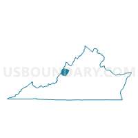
Outline

Summary
| Unique Area Identifier | 681138 |
| Name | Fairview Voting District |
| County | Bath County |
| State | Virginia |
| Area (square miles) | 159.03 |
| Land Area (square miles) | 158.46 |
| Water Area (square miles) | 0.57 |
| % of Land Area | 99.64 |
| % of Water Area | 0.36 |
| Latitude of the Internal Point | 38.08549540 |
| Longtitude of the Internal Point | -79.62338900 |
Maps


Graphs
Select a template below for downloading or customizing gragh for Fairview Voting District, Bath County, Virginia


Neighbors
Neighoring Voting District (by Name) Neighboring Voting District on the Map
- Burnsville Voting District, Bath County, VA
- Deerfield Voting District, Augusta County, VA
- Goshen Voting District, Rockbridge County, VA
- Headwaters Voting District, Highland County, VA
- Healing Springs Voting District, Bath County, VA
- Hot Springs Voting District, Bath County, VA
- McDowell Voting District, Highland County, VA
- Millboro Voting District, Bath County, VA
- Peters Switch Voting District, Alleghany County, VA
- Warm Springs Voting District, Bath County, VA
Top 10 Neighboring County Subdivision (by Population) Neighboring County Subdivision on the Map
- Pastures district, Augusta County, VA (9,772)
- Walkers Creek district, Rockbridge County, VA (5,230)
- Sharon district, Alleghany County, VA (2,212)
- Williamsville district, Bath County, VA (1,074)
- Millboro district, Bath County, VA (966)
- Cedar Creek district, Bath County, VA (944)
- Valley Springs district, Bath County, VA (925)
- Warm Springs district, Bath County, VA (822)
- Stonewall district, Highland County, VA (684)
Top 10 Neighboring Place (by Population) Neighboring Place on the Map
Top 10 Neighboring Unified School District (by Population) Neighboring Unified School District on the Map
- Augusta County Public Schools, VA (73,750)
- Rockbridge County Public Schools, VA (22,307)
- Alleghany County Public Schools, VA (16,250)
- Bath County Public Schools, VA (4,731)
- Highland County Public Schools, VA (2,321)
Top 10 Neighboring State Legislative District Lower Chamber (by Population) Neighboring State Legislative District Lower Chamber on the Map
- State House District 20, VA (76,800)
- State House District 12, VA (75,683)
- State House District 24, VA (72,372)
Top 10 Neighboring State Legislative District Upper Chamber (by Population) Neighboring State Legislative District Upper Chamber on the Map
Top 10 Neighboring 111th Congressional District (by Population) Neighboring 111th Congressional District on the Map
Top 10 Neighboring Census Tract (by Population) Neighboring Census Tract on the Map
- Census Tract 9201, Bath County, VA (4,731)
- Census Tract 9302, Rockbridge County, VA (4,580)
- Census Tract 701, Augusta County, VA (3,968)
- Census Tract 801, Alleghany County, VA (3,362)
- Census Tract 9701, Highland County, VA (2,321)
Top 10 Neighboring 5-Digit ZIP Code Tabulation Area (by Population) Neighboring 5-Digit ZIP Code Tabulation Area on the Map
- 24422, VA (6,315)
- 24445, VA (2,673)
- 24460, VA (1,530)
- 24439, VA (1,253)
- 24484, VA (741)
- 24458, VA (442)
- 24432, VA (336)
- 24487, VA (320)
- 24442, VA (120)